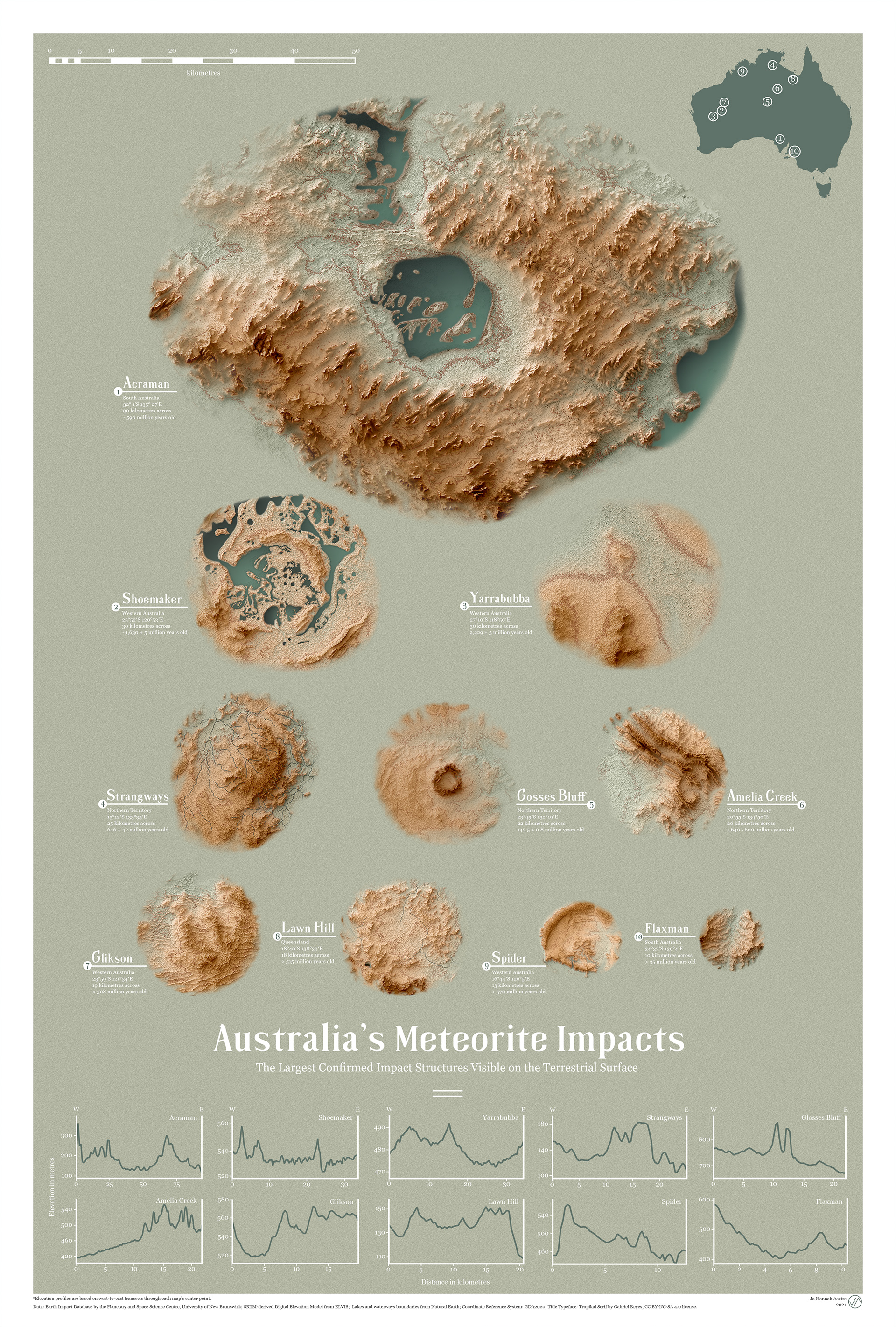
Australia is home to some of the oldest surviving crustal rocks on Earth. The ancient landscape serves as a record of the rich history of our planet, particularly the bolide impacts it has survived in the past. The land down under is fortunate to have preserved 27 out of the 190 recognised impact craters worldwide (Bevan and McNamara, 2009).
This work shows a comparison of the size and profile of the largest confirmed impact structures exposed on the country's surface-- ranging from a 10-kilometre crater to a whopping 90-kilometre structure filled with ephemeral lakes.

Time-lapse of the layering process
These mementos were forged by the might and power of rocky visitors from the vast cosmos, serving as a constant reminder of both the fragility and resilience of our planet.
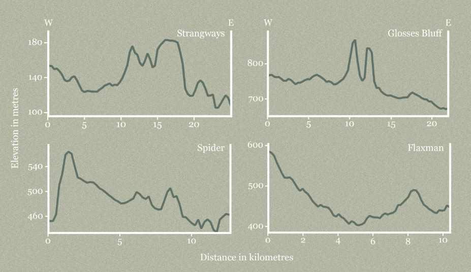
Elevation profiles are based on west-to-east transects through each map’s center point, and are extracted from respective DEMs in QGIS.
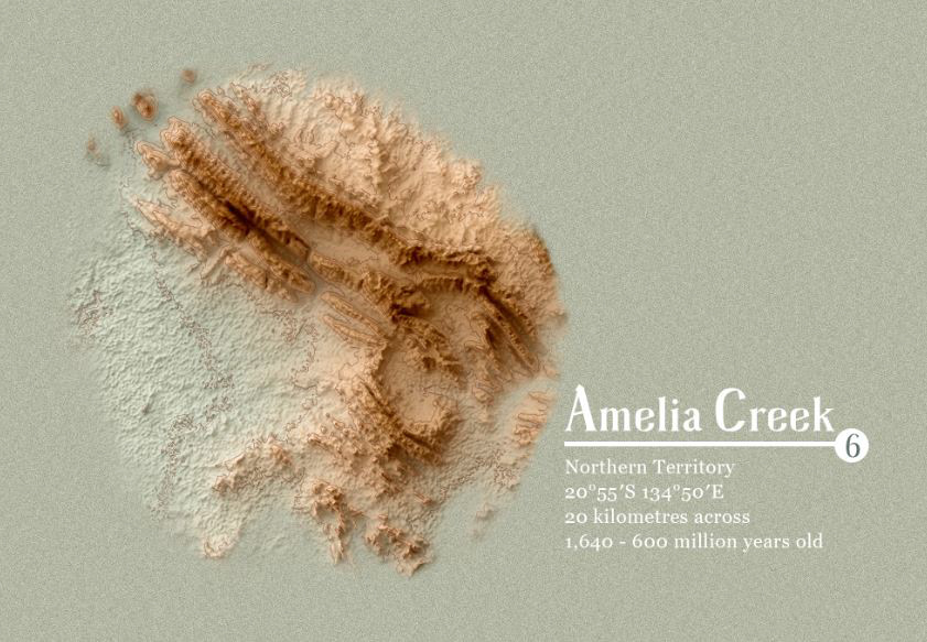
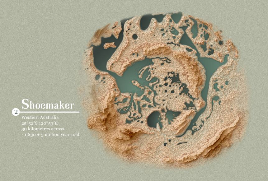
This poster shows the top ten largest impact structures exposed on Australia’s terrestrial surface. As shown by the terrain maps, these sites are characterised by varying degrees of preservation due to weathering and erosion.
The impact structures of Australia are unique sculpted landscapes-- boasting of striking ridges and valleys that through time, have evolved into places of various cultural, ecological, and economic significances.
Data:
Earth Impact Database by the Planetary and Space Science Centre, University of New Brunswick
SRTM-derived Digital Elevation Model from ELVIS
Lakes and waterways boundaries from Natural Earth
SRTM-derived Digital Elevation Model from ELVIS
Lakes and waterways boundaries from Natural Earth
Coordinate Reference System: GDA2020
Title Typeface: Tropikal Serif by Gabriel Reyes
CC BY-NC-SA 4.0 license.
If you are interested in a high-resolution version for prints or digital wallpapers, please get in touch!