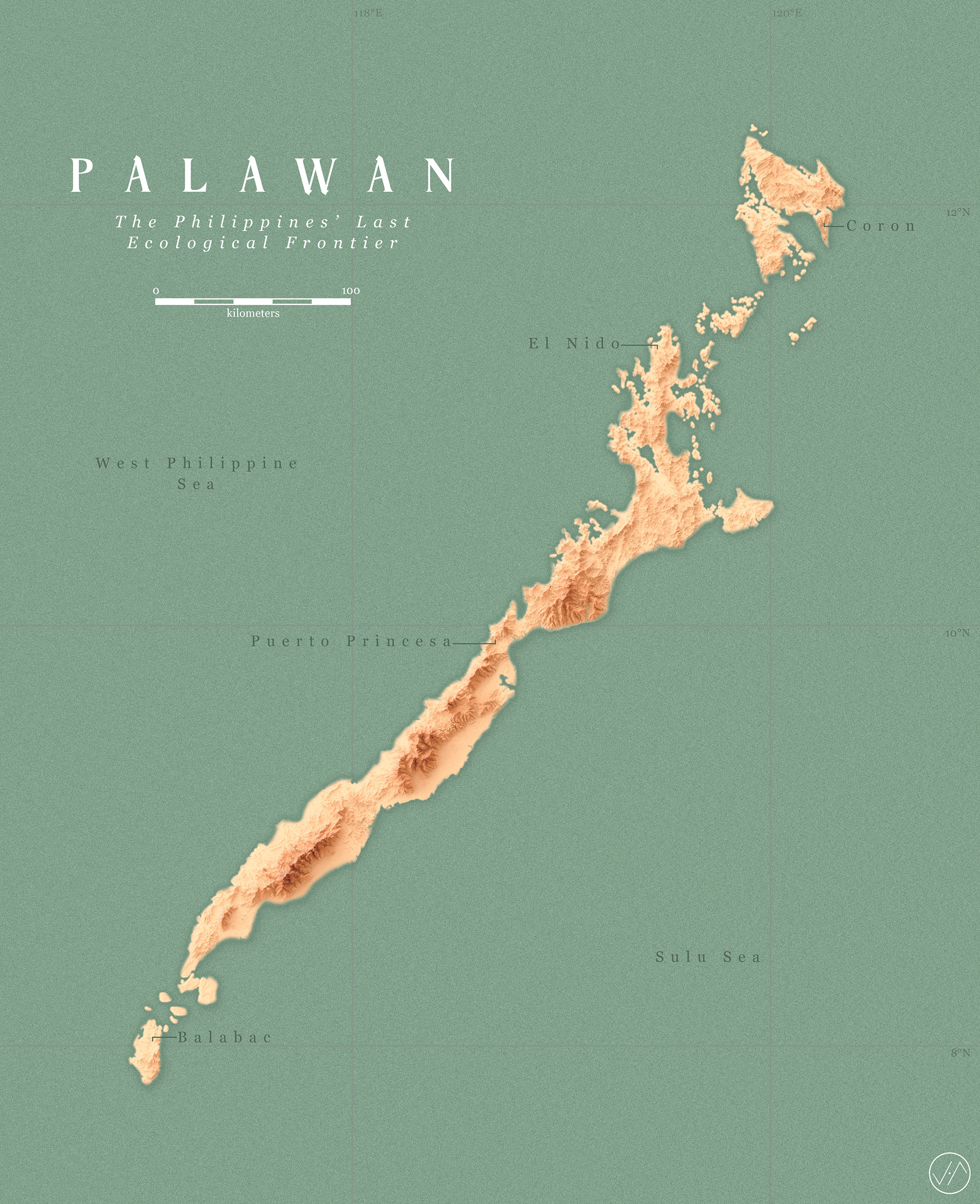
A shaded relief map of the Philippines' last ecological frontier, the Palawan group of islands. Palawan is the country's largest province by land area, and is home to a rich biodiversity, white sandy beaches, and a UNESCO World Heritage Site.
Digital elevation model used is from SRTM Data. Rendered using combined tools from QGIS, Blender, and Adobe Photoshop.