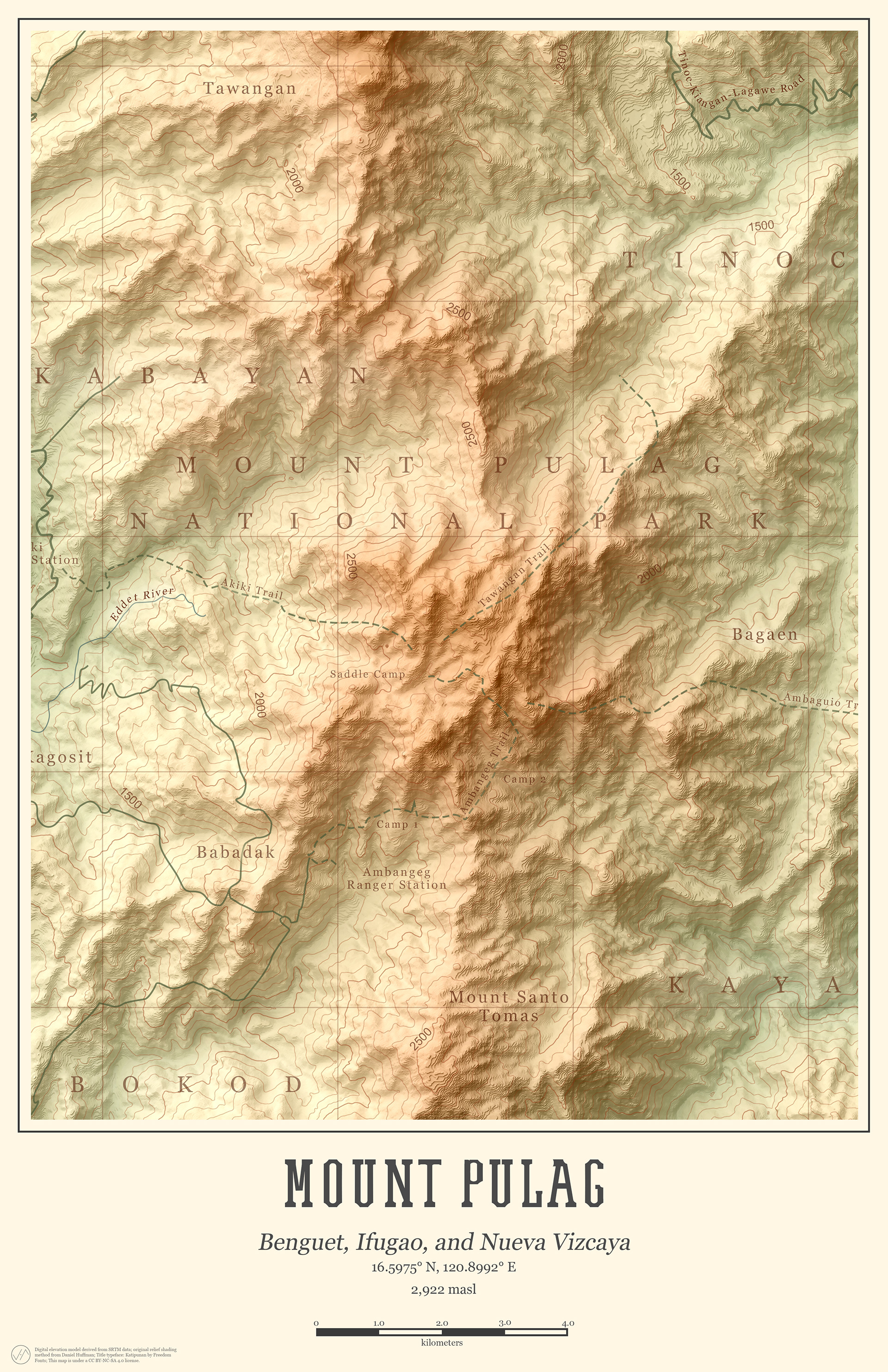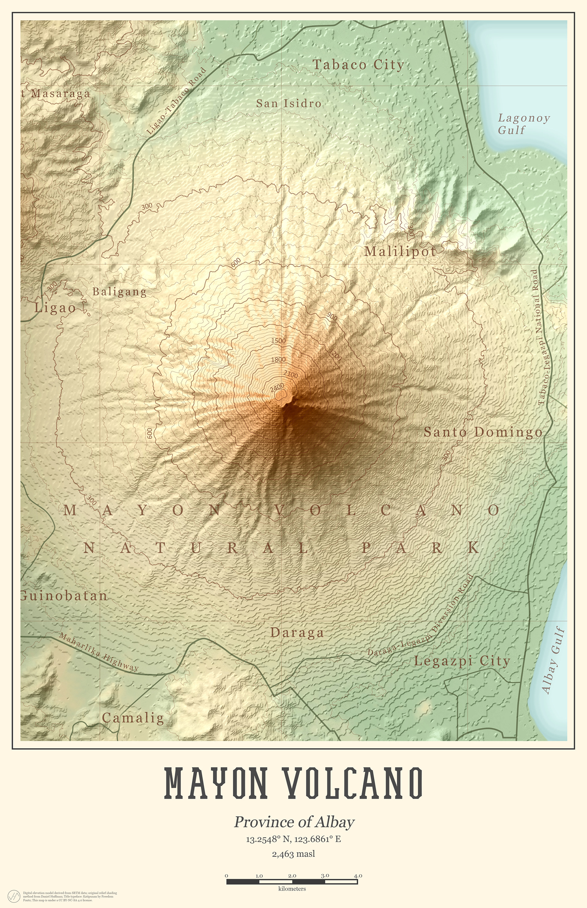
Our iconic mountains are vital features of our land. They serve as barriers to protect us from drastic impacts of typhoons, supply freshwater to communities, provide a home to thousands of plant and animal species, and inspire us with their raw and breathtaking beauty.
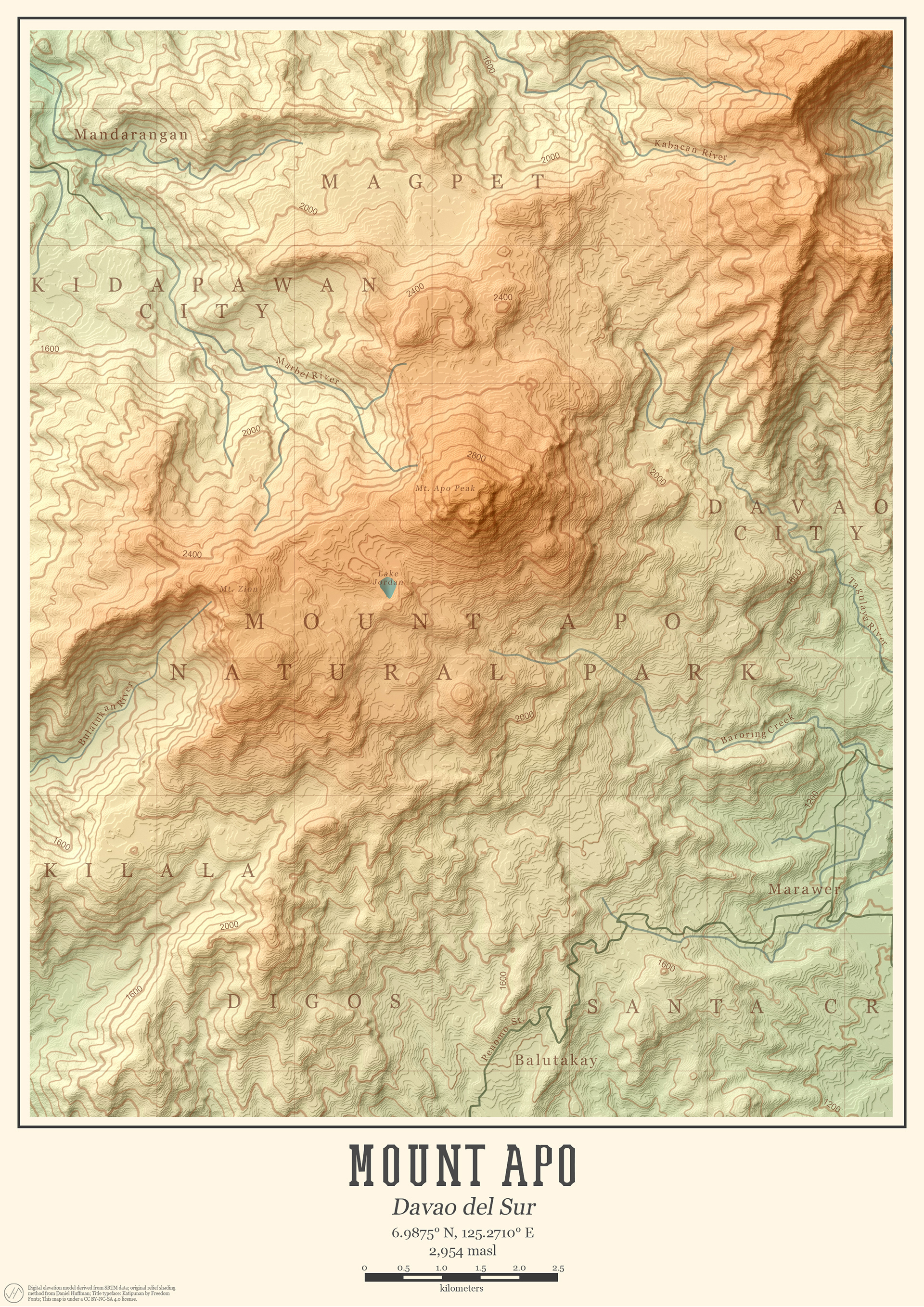
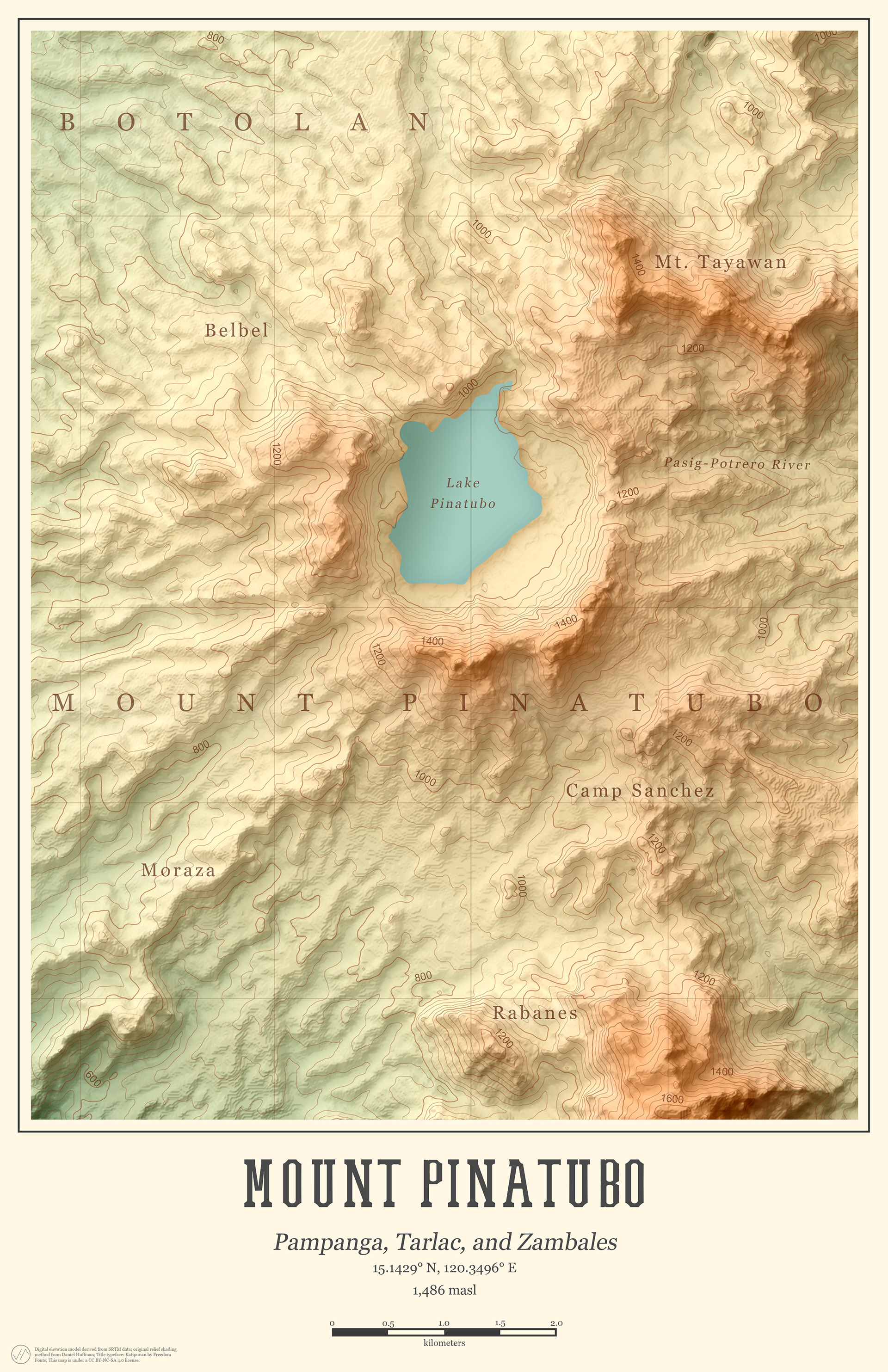

This series of shaded relief maps of renowned Philippine mountains and volcanoes is produced in collaboration with Where To Next PH.
Datasets used for these maps are digital elevation models from the Shuttle Radar Topography Mission. Maps are produced using combined tools from QGIS, Blender, and Adobe Photoshop.